


| Geographical information systems |
Digital mapping • Geocoding
| Digital mapping | |
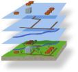 |
The representation of georeferenced data in a visual form provides considerable advantages for the analysis and interpretation
of coherences and changes. An important application area of visualisation techniques is digital mapping. Our activities include
the construction of complex maps from vector, raster and thematic data as well as the creation of digital thematic and
statistical maps e.g. concerning traffic
volumes, emissions or location of census points. We also offer consul- ting on a conceptual level e.g. visualisation of
technical themes or development of suitable layouts. For the presentation of georeferenced data in analogue and
digital maps
we apply the software packages MapInfo and ArcView.
|
| Geocoding | |
|
Geographical information systems provide the technical premises for an efficient management and multifunctional processing of
network and regional specific road data. The thematic data of the Federal States, which are used for road planning, are
transferred into the Federal Highway Information System (BISStra)
and amongst others visualised pursuant to the course of road network. Our activities include the geo- coding and
association of data to the geographic road data of the BISStra according to the road information bank instructions (ASB) as
well as the road network administration of the ASB data.
|